The term “UXO Survey” refers to the collection and analysis of data, using appropriate technical interventions, about the presence, type, distribution, and surrounding environment of Explosive Ordnance contamination, to define better where UXO contamination is present, and where it is not, and to support survey and clearance prioritisation and decision-making processes through the provision of evidence.
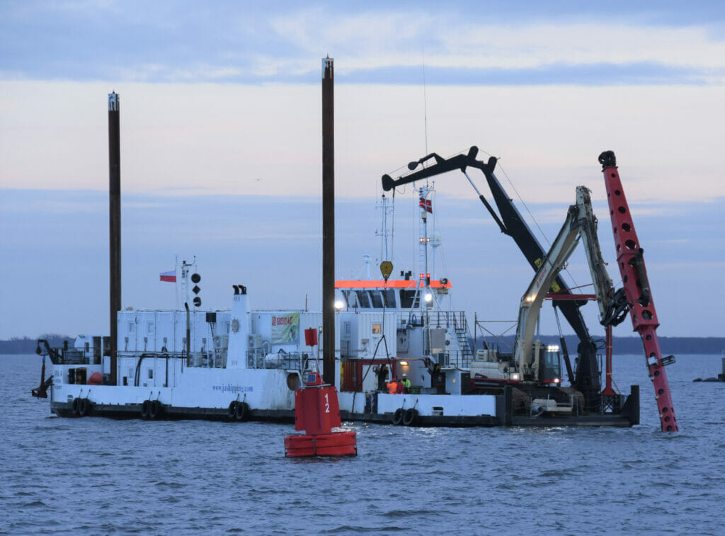
With an extensive track record of UXO surveys in the European renewables sector, UXOcontrol offers proven systems of work based around industry-leading technology. UXO geophysical surveys are conducted to locate and accurately position all potential Explosive Ordnance (EO) items. These same surveys may also be used to identify other hazards or impediments to windfarm installation, such as boulders, debris, or archaeological items. Our surveys normally encompass multibeam bathymetry and side scan sonar for highly accurate and detailed maps of water depth and seabed morphology. In conjunction, detection of ferrous items is achieved with fit for purpose solutions varying from single towed magnetometers to rigid gradiometer arrays frame mounted or deployed on a dual mag wing for more controlled and efficient surveying.
Information management is an integral part of all activities in our underwater survey and clearance operations. It refers to the continual process of conducting information needs assessments, data collection, data analysis, and information dissemination in support of operations. IM is also used to satisfy the reporting requirements of relevant stakeholders. Data collection and analysis. Visual and tactile survey methods require manual input of data into a GIS. Information on UXO contacts should include geographic coordinates, water depth, bottom type, current, ordnance type, fuse type and condition (armed/unarmed/unknown), percentage burial and other relevant information. More advanced sensor data is processed and analysed directly through GIS software. The software enables mission planning to employ the system and post-mission analysis of the data collected with the ability to display a geo-referenced graphic or mosaic of information from each of the data sources. The data e.g., acoustic, and magnetic sensor must go through an assessment process in which an analyst identifies contacts or anomalies that meet specified Explosive Ordnance criteria. Overlaying and displaying the georeferenced data on nautical charts in characterising the Project site. Other data, such as photographs from divers or ROVs, also prove useful if geo-referenced to sensor contacts and anomalies. Contacts and anomalies from acoustic and geophysical sensors are routinely verified to validate sensor performance. Visual verification is normally conducted via diver or ROV/ROD/AUV camera.
With our inhouse datacentre and GIS specialists we deliver efficient and accurate all data and targets picked according UXO threat analyse and project specifications. After a quality check by the Survey and EOD Superintendent a Master Target Catalogue and GIS is delivered to the client and vessel for UXO investigation.
Our certified and evolving quality management system ensures the highest level of quality assurance, and our data storage systems ensure data integrity and security.